First of all, my prayer and deepest sympathy for those that are affected by the flood in Klang, Shah Alam, and other areas.
Hope those affected will recover quickly and bounce back from this banjir.
Topology-wise, TA, ES, and most of BR are sitting on higher ground compared to their surrounding areas. That is why the Sungai Klang flows curves upward/north at Kampong Lombong toward Kota Kemuning and Taman Sri Muda on its way to Selat Melaka.
The land here is also higher compared to places like Bandar Botanic, Bandar Bukit Raja, parts of Klang and parts of Setia Alam, etc.
Besides, the Tropicana East lake and Tropicana West lake are designed to act as water retention ponds during flood seasons. They are working as designed as of now.
Among the 4 developers here,
ES is on the highest ground eg Monterey and Terazza neighbourhoods,
TA land is higher near the Cheria neighbourhood,
BR land is higher near Starling and Perinwinkle neighbourhoods.
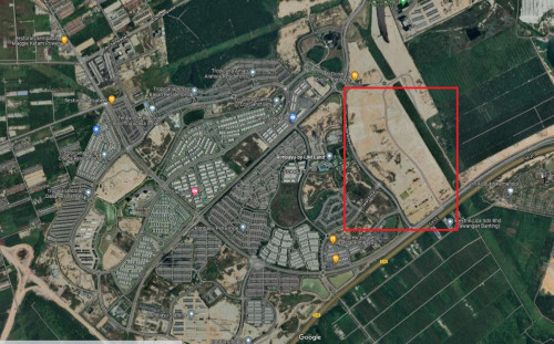
Gamuda 257 neighbourhood’s topology is the lowest. However, it has some big quarry and mining lakes near it that can act as water retention ponds just in case Sungai Klang overflows at the Kampong Lombong area.
Example of the quarry near G257.
https://youtu.be/QkH7Mlumjb0?t=95

 Dec 20 2021, 03:41 PM

 Quote
Quote


 now on waiting list only
 0.0221sec
 0.48
0.48
 6 queries
 GZIP Disabled