

 Mar 14 2006, 12:18 PM, updated 16y ago
i am making a trip there. for those who are interested in going please take part here.
ROUND 2
DATE: 11TH APRIL 2006
DAY: TUESDAY (PUBLIC HOLIDAY)
TIME: 08.00 AM
MEETING PLACE: BP STATION OPPOSITE SMK TMN MELAWATI.
QUOTE
Round 1
date: 19th March 2006
day: sunday
time: 7.30 am (meeting there)
Warning: it is tough, not suitable for beginners, but if u are fit, u can always give it a try. and the ridge is high, if u are afraid of height.. beware.. CLIMB AT YOUR OWN RISK
things to bring:
water (1 bottle of 1.5litre is enough.. more would be better)
sling back (small backpack, make sure your hands are free)
one set of clothings, you sweat, you smell. there is a river down the dam you can actually swim there
some food for picnic. bread, biscutes... whatever.
how to get there?
drive MRR2 all the way until you reach Zoo Negara (from KL City) . Zoo will be on your right. keep to the left and go towards the traffic light under the bridge. make a right turn and go straight. You will pass by 2 schools on your right. One of them is SMK Tmn Melawati (not sure the name). go straight until u reach a roundabout, make a 9 o clock turn. go straight to the 2nd roundabout and make a 12 oclock turn (u are at 6 oclock) go straight up the hill and turn right. turn right again at the next junction (by now the road is really narrow) go straight in and u will reach the Klang Gates Damn. there is the starting point.
how high is it?
not sure. but it is a ridge.. i hike from peak to peak
how long does it take for a beginner?
about 4 hours. fit person 3 hours to complete the whole journey up and down
1-10, how tough is it?
i would say it is at 7.. begining was ok.. rocky part is hard... and it is dangerous coz the ropes provided there are run-downed.. and some parts dun have ropes. you can get to see the valley down there.
how much to spent?
depends on where u come from. I am from Klang.. estimate for RM 20 per trip for toll and petrol.
More info here:
http://www.wwfmalaysia.org/Features/spaces/KlangRidge.htm
http://www.mns.org.my/article.php?sid=611
pictures of my previous climbs
http://pg.photos.yahoo.com/ph/leongjuichua...chuan/my_photos
pictures taken 2 yrs ago.. my last trip was last month..
I have adopted one picture from musangpulut thread gunung bunga buah.. if i am not mistaken Klang gates should be there...
date: 19th March 2006
day: sunday
time: 7.30 am (meeting there)
Warning: it is tough, not suitable for beginners, but if u are fit, u can always give it a try. and the ridge is high, if u are afraid of height.. beware.. CLIMB AT YOUR OWN RISK
things to bring:
water (1 bottle of 1.5litre is enough.. more would be better)
sling back (small backpack, make sure your hands are free)
one set of clothings, you sweat, you smell. there is a river down the dam you can actually swim there
some food for picnic. bread, biscutes... whatever.
how to get there?
drive MRR2 all the way until you reach Zoo Negara (from KL City) . Zoo will be on your right. keep to the left and go towards the traffic light under the bridge. make a right turn and go straight. You will pass by 2 schools on your right. One of them is SMK Tmn Melawati (not sure the name). go straight until u reach a roundabout, make a 9 o clock turn. go straight to the 2nd roundabout and make a 12 oclock turn (u are at 6 oclock) go straight up the hill and turn right. turn right again at the next junction (by now the road is really narrow) go straight in and u will reach the Klang Gates Damn. there is the starting point.
how high is it?
not sure. but it is a ridge.. i hike from peak to peak
how long does it take for a beginner?
about 4 hours. fit person 3 hours to complete the whole journey up and down
1-10, how tough is it?
i would say it is at 7.. begining was ok.. rocky part is hard... and it is dangerous coz the ropes provided there are run-downed.. and some parts dun have ropes. you can get to see the valley down there.
how much to spent?
depends on where u come from. I am from Klang.. estimate for RM 20 per trip for toll and petrol.
More info here:
http://www.wwfmalaysia.org/Features/spaces/KlangRidge.htm
http://www.mns.org.my/article.php?sid=611
QUOTE
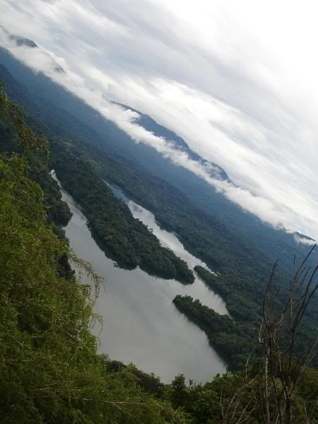
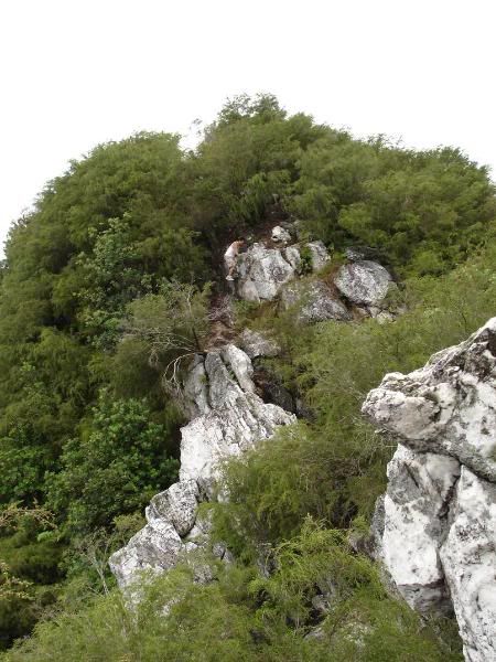
the long line of rocky hills in the distance, the world's longest quartz ridge at the bottom of which lies the Klang Gates. There have been calls from various parties to preserve the quartz ridge as a world heritage site
pictures of my previous climbs
http://pg.photos.yahoo.com/ph/leongjuichua...chuan/my_photos
pictures taken 2 yrs ago.. my last trip was last month..
I have adopted one picture from musangpulut thread gunung bunga buah.. if i am not mistaken Klang gates should be there...
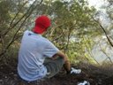
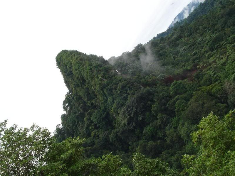
Some pictures:
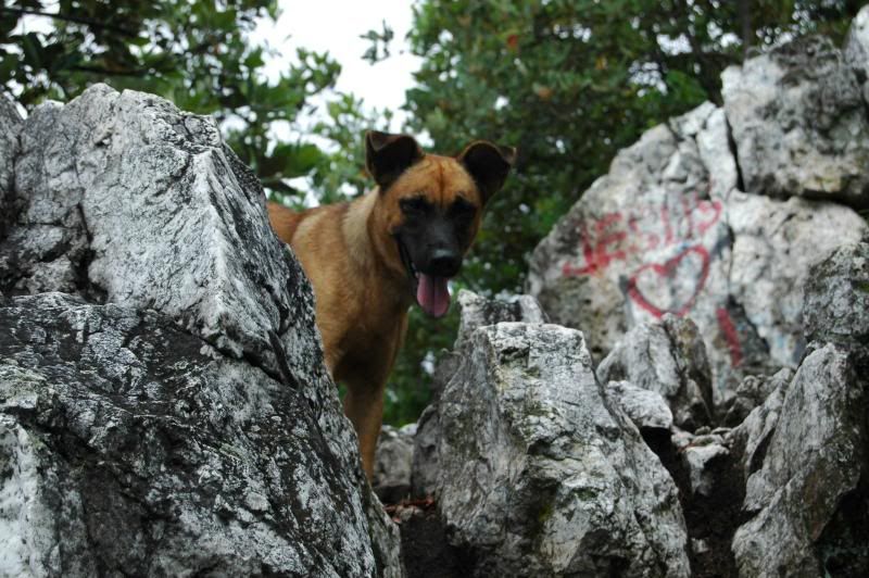
some of the difficult parts of the climb. going down about one storey high.. vertically.. the ropes arent that reliable.. its a bit worn out. so gotta becareful

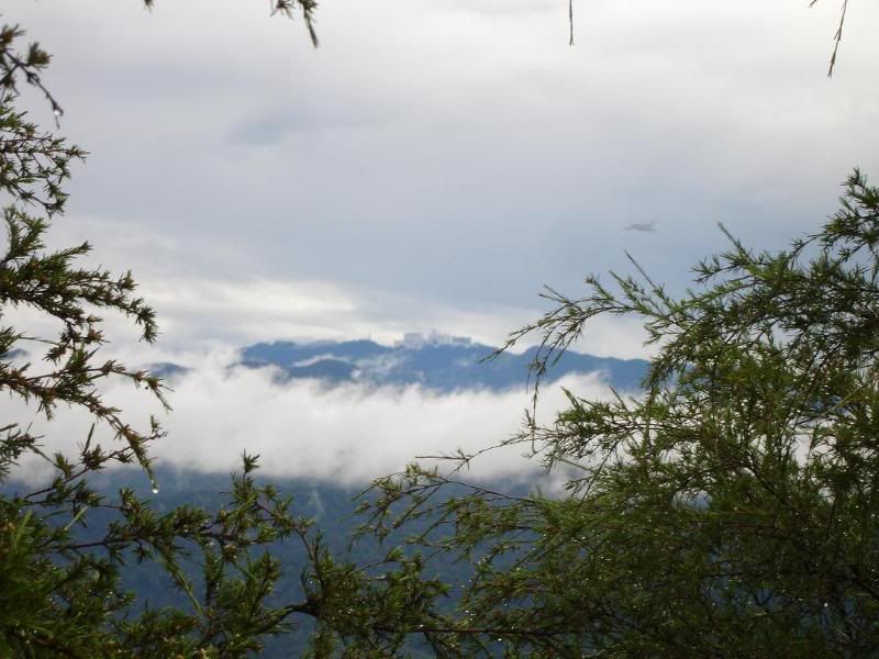
this is my mum. behind her is the Klang Gates dam. so one side u'll get beautiful natural scenery, the other side is the KL city view.

on a big rock..

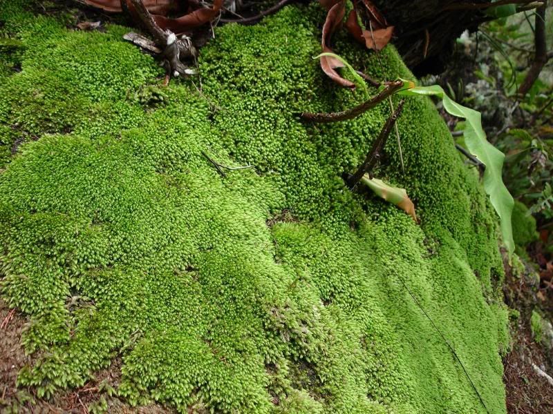
beautiful moss and pokok renek. due to the soil being infertile (rocky texture) the trees on top are generally short. like those u see on Mt Kinabalu climb

taken from one peak to the other.


Map of how to get there from Taman Melawati BP gas station..
This post has been edited by juichuan: Jun 5 2006, 01:15 PM
Attached thumbnail(s)


 Quote
Quote
 wouldn't say it's tough, but can be dangerous.


 so near? those double story houses is it? i will be parking at the dam...


 aiks, since when I became a bee pulak? I'm generally free during weekend for the climb


 gets a bit bored liau.. wanna look for another trail. rukawa.. can we try the ridge opposite the dam?


 Have to sembahyang kuat-kuat.


 ....Geng!!!


 0.2086sec
 0.64
0.64
 6 queries
 GZIP Disabled