

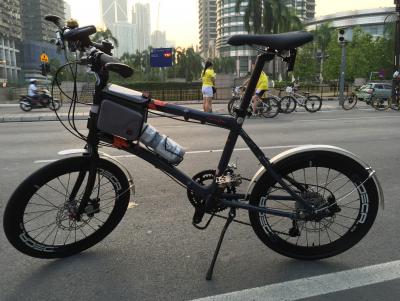
Greetings from KL car free day 😄😄😄
Attached thumbnail(s)
Folding Bicycles v4 - Not only Folding Bikes, Folding bicycle discussion
|
|
 Sep 20 2015, 11:26 AM Sep 20 2015, 11:26 AM
|

Junior Member
12 posts Joined: Jul 2009 |
Good morning everyone!
Greetings from KL car free day 😄😄😄 Attached thumbnail(s)
|
|
|
|
|
|
Sep 20 2015, 11:50 AM
|
|
Junior Member
12 posts Joined: Jul 2009 |
QUOTE(azamunekurone @ Sep 20 2015, 10:55 AM) happy holiday everyone, dont forget to get some workout with ur bike! 👍👍👍  |
|
|
Sep 20 2015, 01:32 PM
|

Junior Member
208 posts Joined: May 2005 From: Kuala Lumpur |
QUOTE(dav668 @ Sep 20 2015, 09:50 AM) Thanks, Bro. I think that is a good choice and well thought purchase. Happy riding!I have just got myself the Dahon SUV D6. Although it does not have aluminium frame it serves my purpose. It comes with rack as well as the mud cover. To my surprise, it costs slightly more than my budget. I have been riding it for a few rounds in housing area yesterday taking my kid. So far so good. Most importantly, i need something easy to maintain as i am very new to foldie. Choosing foldie simply because it has smaller footprint. I carried it from shop yesterday by car. Very space saving. Another option was TRS, i believe the model is 20-25. The shop was selling at RM580. Good in specs. However after reading so many threads and comments i appreciate the value of getting a Dahon, even with the more affordable model and lower specs compare to other models. Not many complains too. http://dahon.com/mainnav/foldingbikes/sing...ike/suv_d6.html |
|
|
Sep 20 2015, 03:09 PM
|
|
Senior Member
1,228 posts Joined: Oct 2008 |
QUOTE(PaulKong @ Sep 20 2015, 11:26 AM) Good morning everyone! Wanted to go this morning but end up going to genting sempahGreetings from KL car free day 😄😄😄 |
|
|
Sep 20 2015, 10:35 PM
|
|
Junior Member
12 posts Joined: Jul 2009 |
QUOTE(kllam @ Sep 20 2015, 03:09 PM) Wanted to go this morning but end up going to genting sempah Wah... Genting sempah. Actually, I want to know, how hard is the ride there? Are there only one route or there are easy, medium and hard route 😁😁😁 |
|
|
Sep 21 2015, 12:31 AM
|

Junior Member
15 posts Joined: Aug 2011 |
Genting Sempah
Distance: 30km ++ 1loop (from Hospital Orang Asli Gombak) (15km uphill) 1,500m elevation gain. Route - medium albeit few steep climbs  |
|
|
|
|
|
Sep 21 2015, 11:06 AM
|
|
Junior Member
12 posts Joined: Jul 2009 |
QUOTE(rkhairulrijal @ Sep 21 2015, 12:31 AM) Genting Sempah I would like to join one day 😍 😍 😍Distance: 30km ++ 1loop (from Hospital Orang Asli Gombak) (15km uphill) 1,500m elevation gain. Route - medium albeit few steep climbs |
|
|
Sep 21 2015, 11:11 AM
|

Junior Member
334 posts Joined: Dec 2004 |
QUOTE(o.d @ Sep 20 2015, 01:32 PM) I think that is a good choice and well thought purchase. Happy riding! Thanks, bro. Will bug you all more after this..  |
|
|
Sep 21 2015, 11:39 AM
|
|
Junior Member
96 posts Joined: Aug 2008 |
 My New Bike by rushd4n, on Flickr My New Bike by rushd4n, on FlickrHello everyone, this is my new bike.. kayuh around tasek only. salam perkenalan |
|
|
Sep 21 2015, 11:58 AM
Show posts by this member only | IPv6 | Post
#2410
|

Junior Member
295 posts Joined: Oct 2009 |
QUOTE(PaulKong @ Sep 20 2015, 10:35 PM) Wah... Genting sempah. Actually, I want to know, how hard is the ride there? Are there only one route or there are easy, medium and hard route 😁😁😁 Genting Sempah (GS), to those who usually rides, is a one way up and one way down. It's 16 kilometers to where most usually turn back. The moment you start, it will climb very gradually and then past the 4th kilometers the inclination gets steeper and thenon the last two kilometers, it gets even steeper. So, it all climb! Then after resting, it's all the way down to the car park. Going down is even more dangerous, especially at the bridge, where there are gaps on the road. That answered, it is only one mode " medium/hard ".In GS, you ride 16 kilometers to an elevation of approximately 634 meters ASL. Many riders after getting seasoned with the route, they will continue down to McDonalds (where the actual GS is) and then ride back UP  Many roadbikers continue to Janda Baik and even Bentong. Many roadbikers continue to Janda Baik and even Bentong.In contrast, Genting Peras (GP) is actually easier or harder , depending on your riding style. In GP, you usually start from the 18th mile Ulu Langat police station. Then it is a 12 kilometer flattish ride, gaining an elevation of 130 meters over 12 kilometers. Quite easy actually. Many riders likes to ride here as the road is cleaner, air is fresher and not as many lorries plying as GS. To those who wants an easier ride, they will turn back after reaching the junction. The last 500 meters is quite steep so most will be puffing already, demoralizing many and wants to turn back. The next section, the tougher section, is 10.5 kilometers to 600 meters ASL. Some parts will be steep, especially the 1km stretch just after the junction and also the last kilometer. With some sporadic sections that are steep, it will sap many new riders. The hardest part (to many seasoned GS riders) is the after getting back down to the junction is the last 12 kilometers flat road back to Ulu Langat. Unlike GS, you suffer the ride up but it's downhill all the way. I personally prefer GP because I find the smell of rotten food hard to bear on the GS stretch. There are many restauranteurs who dump their garbage down the slopes beside GS road. The smell can get over bearing at times. But most definitely, both of these routes is tougher than FRIM  PS/ Most riders don't realize that actually Fraser's Hill is an easier ride. I noticed many riders don't really study the routes. In Fraser's Hill, there is no compulsion to where you want to start or where you want to end. It's only the riders who thinks one must complete the KKB to Fraser's clock tower. I rode 6 times and only twice I do it to the clock tower. I find the last 8 kilometers (very steep) not worthwhile. You see, you have already done 33 kilometers and really tired, why suffer the last 8 km. To really get use or learning to ride hilly terrain, skip the KKB to Sg.Chilling part first. Park your car in Sg.Chilling. Riders are earlier than hikers so the car parking in front of the drinks stall is available. Someone to look after the car, mah! You start here and ride uphill (it's actually very gradual, even horse cart can navigate up). 20 kilometers , you reach GAP. If you don't , doesn't matter as turning back is all the way down, just coasting. !3 kilometers you will reach the waterfall. So, just ride as hard as you can and if you cannot, coast back to the car. Eventually, it be become easy and when you reach that stage, you can start from KKB or occasionally ride the last 8km to the clock tower and take that symbolic picture. Sadly, I see a lot of riders, drive up there and take the pictures as well.  |
|
|
Sep 21 2015, 03:21 PM
|
|
Junior Member
12 posts Joined: Jul 2009 |
QUOTE(etigge @ Sep 21 2015, 11:58 AM) Genting Sempah (GS), to those who usually rides, is a one way up and one way down. It's 16 kilometers to where most usually turn back. The moment you start, it will climb very gradually and then past the 4th kilometers the inclination gets steeper and thenon the last two kilometers, it gets even steeper. So, it all climb! Then after resting, it's all the way down to the car park. Going down is even more dangerous, especially at the bridge, where there are gaps on the road. That answered, it is only one mode " medium/hard ". I'm interested in Genting perez. The 12km is one way, right? So going and coming back will be 24km? The distance looks good for me. I'm thinking of bringing my family to enjoy the scenery there. Is it OK?In GS, you ride 16 kilometers to an elevation of approximately 634 meters ASL. Many riders after getting seasoned with the route, they will continue down to McDonalds (where the actual GS is) and then ride back UP Many roadbikers continue to Janda Baik and even Bentong.In contrast, Genting Peras (GP) is actually easier or harder , depending on your riding style. In GP, you usually start from the 18th mile Ulu Langat police station. Then it is a 12 kilometer flattish ride, gaining an elevation of 130 meters over 12 kilometers. Quite easy actually. Many riders likes to ride here as the road is cleaner, air is fresher and not as many lorries plying as GS. To those who wants an easier ride, they will turn back after reaching the junction. The last 500 meters is quite steep so most will be puffing already, demoralizing many and wants to turn back. The next section, the tougher section, is 10.5 kilometers to 600 meters ASL. Some parts will be steep, especially the 1km stretch just after the junction and also the last kilometer. With some sporadic sections that are steep, it will sap many new riders. The hardest part (to many seasoned GS riders) is the after getting back down to the junction is the last 12 kilometers flat road back to Ulu Langat. Unlike GS, you suffer the ride up but it's downhill all the way. I personally prefer GP because I find the smell of rotten food hard to bear on the GS stretch. There are many restauranteurs who dump their garbage down the slopes beside GS road. The smell can get over bearing at times. But most definitely, both of these routes is tougher than FRIM PS/ Most riders don't realize that actually Fraser's Hill is an easier ride. I noticed many riders don't really study the routes. In Fraser's Hill, there is no compulsion to where you want to start or where you want to end. It's only the riders who thinks one must complete the KKB to Fraser's clock tower. I rode 6 times and only twice I do it to the clock tower. I find the last 8 kilometers (very steep) not worthwhile. You see, you have already done 33 kilometers and really tired, why suffer the last 8 km. To really get use or learning to ride hilly terrain, skip the KKB to Sg.Chilling part first. Park your car in Sg.Chilling. Riders are earlier than hikers so the car parking in front of the drinks stall is available. Someone to look after the car, mah! You start here and ride uphill (it's actually very gradual, even horse cart can navigate up). 20 kilometers , you reach GAP. If you don't , doesn't matter as turning back is all the way down, just coasting. !3 kilometers you will reach the waterfall. So, just ride as hard as you can and if you cannot, coast back to the car. Eventually, it be become easy and when you reach that stage, you can start from KKB or occasionally ride the last 8km to the clock tower and take that symbolic picture. Sadly, I see a lot of riders, drive up there and take the pictures as well. |
|
|
Sep 21 2015, 03:33 PM
|

Junior Member
423 posts Joined: Mar 2007 From: Seoul |
Hi all.
im riding mtb.i find that transporting my bike really hassle. Thinkinh of changing to foldibg bike. But im 90kg.huu.can folding bike support my weight safely? |
|
|
Sep 21 2015, 03:40 PM
|
|
Junior Member
334 posts Joined: Dec 2004 |
QUOTE(mizi28 @ Sep 21 2015, 03:33 PM) Hi all. I read from thread somewhere. The alloy frame will hold up to 110kg. The steel frame will be 10kg to 15kg more. I think the brand and model play a part too, built-quality i believe.im riding mtb.i find that transporting my bike really hassle. Thinkinh of changing to foldibg bike. But im 90kg.huu.can folding bike support my weight safely? |
|
|
|
|
|
Sep 21 2015, 03:40 PM
|
|
Junior Member
12 posts Joined: Jul 2009 |
QUOTE(mizi28 @ Sep 21 2015, 03:33 PM) Hi all. Most folding bike rated to take up to 115kg.im riding mtb.i find that transporting my bike really hassle. Thinkinh of changing to foldibg bike. But im 90kg.huu.can folding bike support my weight safely? |
|
|
Sep 21 2015, 03:48 PM
Show posts by this member only | IPv6 | Post
#2415
|
|
Junior Member
295 posts Joined: Oct 2009 |
QUOTE(PaulKong @ Sep 21 2015, 03:21 PM) I'm interested in Genting perez. The 12km is one way, right? So going and coming back will be 24km? The distance looks good for me. I'm thinking of bringing my family to enjoy the scenery there. Is it OK? 3°09'51.3"N 101°50'48.8"EThe coordinates of where to park your car. If going on Sunday, better be early as there will be many riders. You can have your breakfast there too. On the main road, on the opposite, there's a chinese coffee shop ( all riders knows this place, the iced barley after ride is really oommph! ). It's open after 7.15am. Here's the exact location of the route and path. Right where the path ends, to the left is Genting Peras and to the right is Semenyih where you pass the dam and lake. The elevation is also shown on the link. http://www.mapmyride.com/routes/view/865219413 |
|
|
Sep 21 2015, 03:51 PM
Show posts by this member only | IPv6 | Post
#2416
|
|
Junior Member
295 posts Joined: Oct 2009 |
QUOTE(mizi28 @ Sep 21 2015, 03:33 PM) Hi all. Actually I opted not to carry my MTB and wife's on the roof. We managed to put both bikes in the car. im riding mtb.i find that transporting my bike really hassle. Thinkinh of changing to foldibg bike. But im 90kg.huu.can folding bike support my weight safely? Anyway, Dahon foldies are rated to carry 105 kgs. That's actually a proven figure as I am 100 kgs and have ridden all over and even off road too on a foldie. No issues as long as you get branded ones. Dahon is a good choice.  |
|
|
Sep 21 2015, 03:54 PM
|

Junior Member
208 posts Joined: Aug 2009 |
someone here shud organize foldies trip to genting perez !!
|
|
|
Sep 21 2015, 04:27 PM
|
|
Senior Member
1,228 posts Joined: Oct 2008 |
QUOTE(etigge @ Sep 18 2015, 12:25 PM) I am using 2 sets of those thin metal strips that car mechanics used to adjust the tappet valves instead of business cards. For 160mm rotors, it is fairly easy to adjust but for 180mm rotors, it's a nightmare adjusting without the spacers. If you are using old MTB frames, that means a rigid frame. It's much better to use hydraulics and the price is going really cheap nowadays. Even Tektro hydraulics is better than a mechanical setup. I will be upgrading my wife's Deore setup this month's end to XT. If you wish I can sell you the old Deore setup. haven't decide which type of brakes yet, the BB5 mentioned is on my Java Fit. just got my hands on a used Tern Link C7 for a really good price, most probably will mod the C7 first and put the MTB frame on hold first. was thinking of either mod to 18 or 20 speed. which do u think is more suitable? thanks QUOTE(PaulKong @ Sep 20 2015, 10:35 PM) Wah... Genting sempah. Actually, I want to know, how hard is the ride there? Are there only one route or there are easy, medium and hard route 😁😁😁 i stop many times, lost count of it before reachingThis post has been edited by kllam: Sep 21 2015, 04:28 PM |
|
|
Sep 21 2015, 04:37 PM
|
|
Junior Member
12 posts Joined: Jul 2009 |
QUOTE(mkaz @ Sep 21 2015, 03:54 PM) someone here shud organize foldies trip to genting perez !! Yup.... I fully support. Hope sifu ettige would agree to organise 😁😁😁 |
|
|
Sep 21 2015, 04:41 PM
|
|
Junior Member
12 posts Joined: Jul 2009 |
QUOTE(etigge @ Sep 21 2015, 03:48 PM) 3°09'51.3"N 101°50'48.8"E The link you provide doesn't seems to show the Genting perez route you have take. I've add you as friend, though The coordinates of where to park your car. If going on Sunday, better be early as there will be many riders. You can have your breakfast there too. On the main road, on the opposite, there's a chinese coffee shop ( all riders knows this place, the iced barley after ride is really oommph! ). It's open after 7.15am. Here's the exact location of the route and path. Right where the path ends, to the left is Genting Peras and to the right is Semenyih where you pass the dam and lake. The elevation is also shown on the link. http://www.mapmyride.com/routes/view/865219413 Attached thumbnail(s) 
|
|
Topic ClosedOptions
|
| Change to: |  0.0227sec 0.0227sec
 0.37 0.37
 6 queries 6 queries
 GZIP Disabled GZIP Disabled
Time is now: 5th December 2025 - 02:42 AM |
 Quote
Quote