South China Sea: Who Claims What in the Spratlys?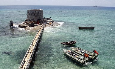
QUOTE
“Unreliable evidence is clouding the international discourse on the South China Sea disputes.”
QUOTE
Consider, for instance, the argument that China, far from being the aggressor in the South China Sea
QUOTE
Vietnam has “doubled its holdings” in the South China Sea in the past 20 years
QUOTE
Even if one assumes that Vietnam occupied 24 features in 1996 (the actual data from which the map often drawn for this line of argument actually specifies 22)
QUOTE
The source for this claim – a 2015 congressional testimony by a senior U.S. defense official – in fact specified 48 outposts amongst the features occupied by Vietnam in the Spratly Islands, rather than 48 features. Using a 20-year timeline is also equally misleading because it leaves out China’s seizure of Mischief Reed 21 years ago
QUOTE
Vietnam
Vietnam currently occupies 21 features in the Spratly Islands, with the latest taken a few days after a bloody clash on March 14, 1988 with China at Johnson South Reef. A full list of these features with their names and coordinates was publicized in the April 22, 1988 issue of Nhan Dan, the Vietnamese government’s mouthpiece. They are:
Southwest Cay (Vietnamese: Song Tu Tay),
South Reef (Da Nam),
Petley Reef (Nui Thi or Da Thi),
Sand Cay (Son Ca),
Namyit Island (Nam Yet),
Discovery Great Reef (Da Lon),
Sin Cowe Island (Sinh Ton),
Collins Reef (Co Lin),
Lansdowne Reef (Len Dao),
Sin Cowe East Island (Sinh Ton Dong),
Ladd Reef (Da Lat),
Spratly Island (Truong Sa or Truong Sa Lon),
West Reef (Da Tay),
Central Reef (Truong Sa Dong),
East Reef (Da Dong),
Pearson Reef (Phan Vinh),
Allison Reef (Toc Tan),
Cornwallis South Reef (Nui Le),
Pigeon or Tennent Reef (Tien Nu),
Barque Canada Reef (Thuyen Chai),
Amboyna Cay (An Bang).
QUOTE
S. Department of Defense (DoD) identified 34 outposts on these 21 features
QUOTE
Vietnam also has a similar counting system, but it identifies only 33 outposts (diem dong quan or diem dao in Vietnamese). Why the discrepancy? The extra outpost counted by DoD is a lighthouse on Tennent Reef
QUOTE
Philippines
Philippine media typically reports either nine or ten Philippine-held features in the Spratly Islands. The tenth feature is Irving Reef (Filipino: Balagtas), which lies between Loaita Bank and West York Island. There are no structures on this reef, but unverified sources report that Philippine Navy ships take turns to guard the feature. If this is true, the status of Irving is similar to that of several other features that are watched by Chinese and Vietnamese vessels but remain unoccupied.
Given this, the nine features held by the Philippines in the Spratly Islands are:
Northeast Cay (Filipino: Parola),
Thitu Island (Pag-asa),
Loaita Cay (Panata),
Loaita Island (Kota),
West York Island (Likas),
Flat Island (Patag),
Nanshan Island (Lawak),
Second Thomas Shoal (Ayungin),
Commodore Reef (Rizal).
QUOTE
APMSS map shows no outpost at Lankiam Cay. Instead, it locates the second Philippine outpost in Loaita Bank at an unidentified reef northwest of Loaita Island. Some Chinese and Vietnamese sources identify this Philippine-occupied feature as Loaita Nan. However, the coordinates commonly associated with Loaita Nan (100 42.5’ N, 1140 19.5’ E) refer to the reef that forms the western edge of Loaita Bank, where no structures are visible from satellite images available in Google Maps. At the same time, small structures are visible on Loaita Cay (100 44’ N, 1140 21’ E), which might be thought of as part of Loaita Nan but actually lies east across a seven-meter deep channel. Loaita Cay is 6.5 nm northwest of Loaita Island
QUOTE
Between 1970 and 1978, the Philippine moved in to occupy seven features in the Spratlys, with troops stationed on five islands. Flat Island, which lies about 6 nm north of Nanshan Island, appeared to be controlled by a garrison based at Nanshan until 2011, when some starshell-like structures were built on Flat to house a more permanent presence. A documentary produced by a local TV network in 2004 reported that only four soldiers were guarding both features from their shelters on Nanshan
QUOTE
In 1999, the Philippines occupied Second Thomas Shoal by running the tank landing ship BRP Sierra Madre aground and using it as a shelter for a small garrison. Of note, the Pentagon does not count the Philippine station on Second Thomas Shoal as an outpost
QUOTE
Taiwan
Itu Aba Island (Chinese: 太平島) is the only feature occupied by Taiwan in the Spratlys. It is also the largest natural land feature in the archipelago. Taiwan sometimes is said to hold two features there. This is likely to be inferred from reports of Taiwan erecting structures (in 1995 and 2004) and its officials landing (in 2003 and 2012) on Ban Than Reef. However, the best description of Ban Than’s current status is “unoccupied.” Ban Than has a beach less than 100 meters long, which lies about 2.5 nm from Itu Aba and about 4 nm from the Vietnamese-occupied Sand Cay. The Pentagon identifies no outpost on Ban Than, and no structures are visible in recent satellite images as well as photos of the reef. Sources with local knowledge told me that both Taiwanese and Vietnamese troops have occasionally planted materials on Ban Than and used them as targets for their live-fire exercises.
QUOTE
China
In the Spratly Islands, China has occupied six features since 1988 and Mischief Reef since 1995. The seven features occupied by China in the Spratly Islands are:
Subi Reef (Chinese: 渚碧礁 Zhubi Jiao),
Gaven Reef (南薰礁 Nanxun Jiao),
Hughes Reef (东门礁 Dongmen Jiao),
Johnson South Reef (赤瓜礁 Chigua Jiao),
Fiery Cross Reef (永暑礁 Yongshu Jiao),
Cuarteron Reef (华阳礁 Huayang Jiao),
Mischief Reef (美济礁 Meiji Jiao).
QUOTE
When the Pentagon in May 2015 said there were eight Chinese outposts in the Spratly Islands, some thought that the eighth was Eldad Reef. But the APMSS map released three months later shows two outposts on Mischief alone, and none on Eldad. This is a fact that has often been missed
QUOTE
The mistaken status of Eldad, Whitsun, and Ladd Reefs is likely to have been inferred from reports about Vietnam protesting against Chinese troops landing on Eldad Reef in 1990, Da Ba Dau in March 1992 and Da Lac in July 1992
QUOTE
Several stories in the Vietnamese social media suggest that Eldad, Whitsun, and McKennan are frequently sites of quiet cat-and-mouse games between China and Vietnam, one attempting to get a foothold on these ‘new islands’ while the other tries to frustrate these efforts
QUOTE
A similar situation has been going on at South Luconia Shoal (Malay: Beting Patinggi Ali) 84 nm off the coast of Malaysia’s Sarawak. Both Chinese and Malaysian officials have confirmed that China’s vessels have been continually present at the shoal since 2013. Intriguingly, one of the features in the shoal, Luconia Breakers (Malay: Beting Hempasan Bantin), appears to have changed status from a low-tide elevation to a “small island,” to use the words of Malaysia’s Minister in the Prime Minister’s Department Shahidan Kassim. Satellite images and aerial photos show a sand dune of about 70 meters in length on this feature. They also show Chinese Coast Guard vessels, shadowed by Malaysian Navy ships, anchoring near the ‘new island.’
Some scholars argue that Luconia Breakers was reclaimed into an artificial island by Malaysia sometime prior to 2009. But this argument makes little sense. As the coastal state with an EEZ over the shoal, Malaysia has a strong interest in keeping the feature submerged. A 2012 judgment by the International Court of Justice stated that “low-tide elevations cannot be appropriated.” Following from this, Luconia Breakers might be legally protected from China’s sovereignty claim if it remains a low-tide elevation.
QUOTE
Malaysia
As with the case of the Philippines, the number of Malaysian-held features in the Spratlys varies depending on how one defines occupation. Most accounts typically speak of either five or eight features. Malaysia has troops and facilities stationed on five features:
Swallow Reef (Malay: Layang-Layang), since 1983,
Ardasier Reef (Ubi), since 1986,
Mariveles Reef (Mantanani), since 1986,
Erica Reef (Siput), since 1999,
Investigator Shoal (Peninjau), since 1999
QUOTE
Several sources also list three more features, including Dallas Reef (Laya), Royal Charlotte Reef (Semarang Barat Besar), and Louisa Reef (Semarang Barat Kecil), as occupied by Malaysia. However, more recent, reliable, and knowledgeable sources from Malaysia, Brunei, and the United States confirm that there are in fact no troops stationed on these three features
QUOTE
Malaysia appears to “occupy” Dallas Reef in a similar way to how the Philippines did with Flat Island. Troops from nearby Ardasier Reef, which lies about 3 nm from Dallas Reef, may watch and visit the latter on a regular basis. Royal Charlotte and Louisa Reefs, on the other hand, can hardly be classified as “occupied.” While there is a beacon on Royal Charlotte, visitors report that it was inactive and there were no others structures on the reef. Visitors have also found Louisa deserted with no other structures than an obelisk-shaped beacon, which was also not working. Among these eight features, Swallow, Mariveles, Erica, Royal Charlotte, and Louisa Reefs reportedly have some natural portions protruding above high tide, while Ardasier, Dallas, and Investigator are likely low-tide elevations. The beacons on Royal Charlotte and Louisa might have been built by Malaysia in the 1980s as a means to assert sovereignty over the two reefs
QUOTE
Brunei
The only feature in the Spratly Islands that is claimed by Brunei is Louisa Reef. According to official statements by Malaysia and Brunei, an Exchange of Letters signed in 2009 has “established the final delimitation of territorial sea, continental shelf, and exclusive economic zone” between the two countries. The agreement unequivocally states that Brunei has sovereignty over two oil blocks within which Louisa Reef is located.
Although Malaysia has not officially dropped its territorial claims over this feature, the agreement with Brunei substantially weakens Malaysia’s claims. As both Malaysia and Brunei have grounded their sovereignty claims over Louisa on the basis of coastal state rights, Malaysia’s acknowledgement of Brunei’s territorial sea, continental shelf, and EEZ is tantamount to effectively conceding Louisa Reef to Brunei. However, this appears to be a tacit understanding rather than an official agreement of any kind. The Exchange of Letters has yet to be publicized, and even if it would be made public, there would likely be no mentioning of Louisa. This is certainly the case with Limbang District, the other territorial dispute between Brunei and Malaysia.
http://thediplomat.com/2016/05/south-china...n-the-spratlys/This post has been edited by BorneoAlliance: May 6 2016, 11:52 PM 

 May 4 2016, 05:59 PM


 Quote
Quote


 0.0864sec
 0.65
0.65
 7 queries
 GZIP Disabled