Welcome Guest ( Log In | Register )

Bump Topic Topic Closed RSS Feed

Outline · [ Standard ] · Linear+

Travel Cameron Highland, Recommended things to see and do?

views
     
Traveler
post Jun 4 2009, 09:38 AM

Mad HD and SSD Collector
Group Icon
Elite
811 posts

Joined: Jan 2003
From: Aemon's Field


QUOTE(kapalterbang_737 @ Apr 24 2009, 02:16 AM)
The road lil bit wet, and the corners there makes me as driver also dizzy. Aiyak. But the wind there, superb! even cooler than aircond in car  laugh.gif  Maybe bcoz it's raining the night before. Didn't see the sun for the whole day. Only managed to went to Boh Centre and Kea Farm because got to catch up with time. Nice place! Around 5.30 pm depart home. doesn't have the guts to drive at night, the road freaking me out. Dark+sharp corners.
*
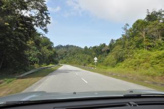
Which road up did you take? Via Simpang Pulai or the old Tapah road? I've gone up to Cameron twice on the Simpang Pulai road at night. Very very very dark, windy roads, with very few cars. If you want to do this, highly recommend you travel in a convoy of cars so incase of breakdown you have friends to help out. But if you like driving, you will enjoy the uphill night climb. Especially when you get close to Kg Raja just before Brinchang, you will see lots of lit "domes" for the vegetable farms. I always thought they look like something from the X-Files.. hehe. cool2.gif

QUOTE(ahjames @ May 28 2009, 11:16 AM)
Hehe, price also very nice. Had a drink there one night, and wandered around a bit. Very nice place indeed. But at that price, I'd rather stay in their Pangkor Laut resort.. similar price but you get so much more.

QUOTE(stimix @ Jun 2 2009, 10:59 PM)
Just to share what I did during my recent CH trip on Saturday & Sunday....I went for Refllesia flower hunting!!

I booked the 1/2 day tour from TJ Tour at Tanah Rata (RM60/pax & RM30/child)..Meeting point at Kea farm butterfly farm. The road trip took me ~45min from Kea Farm to Lojing in Gua Musang Kelantan.
Like Kimmie asked earlier... would you mind sharing further details of the tour? Where is the Kea farm where they picked you up, was it in Tanah Rata? Was a mid-morning to mid-afternoon tour or an early morning till noon tour? How was the weather? Cooler like Brinchang or just cool like Tanah Rata? Sunny? Sorry for so many questions... just quite interested to find out. Thanks. smile.gif
Traveler
post Jun 12 2009, 10:28 AM

Mad HD and SSD Collector
Group Icon
Elite
811 posts

Joined: Jan 2003
From: Aemon's Field


QUOTE(platingirl @ Jun 10 2009, 04:34 PM)
Planning to drive up using Simpang Pulai road, using a van.

Hope its safe :S
*
Should be fine. Simpang Pulai road is easier and less windy than the Tapah road. Just don't take the corners too fast smile.gif
Traveler
post Jan 4 2010, 05:00 PM

Mad HD and SSD Collector
Group Icon
Elite
811 posts

Joined: Jan 2003
From: Aemon's Field


QUOTE(stimix @ Jan 3 2010, 08:57 PM)
Yeah I knew that one.. I was tracking 1/2 way that road from Ringlet trying to goto Sg koyah way back in 2007 too but stopped 1/2 way after Bertam valley Village..road condition very bad..not for my sedan car.. blush.gif  So during my long journey to visit Gua Musang for the 1st time instead using this bypass I chicken out bcos I knew the condition closer to Bertam valley..Anyway, the road has since been tracked by one of Malsingmaps member way back in early 2008 7 updated thereafter in both malsingmaps & MFM.. rclxms.gif

Yet still no one feedback since then whether the last portion of the road between Bernam Valley & kg Susu/ Kg manso still accessible by sedan cars??

Added on January 3, 2010, 8:59 pmCameron itself sufficient dy..lotsa attractions..One of my best - Hiking in search for Rafflesia flower....well it's a paid 4WD trip anyway.. blush.gif
*
I was looking at Google Maps trying to see which road you meant, and noticed one that may be what you are referring to. Is this a road from Ringlet to Sg Koyan that uses C156 (as labeled in Google Maps), where the unconnected portion is the road you meant?


Traveler
post Jan 8 2010, 04:32 PM

Mad HD and SSD Collector
Group Icon
Elite
811 posts

Joined: Jan 2003
From: Aemon's Field


QUOTE(stimix @ Jan 8 2010, 09:29 AM)
Op[ss Overlooked earlier.. blush.gif  Yeah that's the road from Sg Koyan >Kg Susu>Kg Manson>Bertam Valley & Ringlet i'm talking about. Google maps stopped somewhere ~ kg Susu as you posted. According to malsingmaps V3.09, The road from Kg Susu to about 5KM b4 bertam Valley (That's where I stopped & patah Balik in 2007) is still unpaved. Well I'm not sure about the status right now because in Malfreeemaps it's a paved road ..confusing.. rclxub.gif
Oh.. that looks interesting. Do you think the road is passable for novice 4x4 drivers? ie, city drivers with no experience in hard-core off-roading.
Traveler
post Jan 9 2010, 03:24 AM

Mad HD and SSD Collector
Group Icon
Elite
811 posts

Joined: Jan 2003
From: Aemon's Field


QUOTE(stimix @ Jan 8 2010, 04:57 PM)
Should be OK.. I even saw lotsa Sedans car passing by but those were really teruk type od sedans..Me not dare...Dunwan to regret later...

Do report back on the status of this road..I think should be tarred by now  hmm.gif
*
Cool... now all I have to do is persuade my dad to lend me his new 4x4 for a long weekend, hehe!
Traveler
post Jan 21 2010, 03:37 PM

Mad HD and SSD Collector
Group Icon
Elite
811 posts

Joined: Jan 2003
From: Aemon's Field


I found this blog that detailed the author's trip via the Sg Koyan-Ringlet road in June 2009 (with pictures of the road). Apparently most of the way is paved except for a 12km stretch. It took them a little under 2 hours from Sg Koyan to Ringlet. Looks like any standard trunk road with a mild "off-road" stretch. Am planning my own journey next weekend, so I hope to be able to update the info. Who knows.. maybe when I get on it, it will be fully paved.

Also found this article at The Star website:

http://thestar.com.my/metro/story.asp?file...&sec=southneast

QUOTE
Friday August 28, 2009
New road to Cameron Highlands
BY NIK NAIZI HUSIN


CAMERON HIGHLANDS: Travelling time to Cameron Highlands from Sungai Koyan in Lipis district is expected to take less than an hour with a new road now under construction and scheduled to be completed in March next year.

Pahang Mentri Besar Datuk Seri Adnan Yaakob said the 79.1km road costing RM806mil would shorten the route from Kuantan to the highlands tourist attraction by about 80km.


In progress: Part of the Lipis-Cameron Highlands Highway which is still under construction.
It will pass through Pos Betau, Kampung Meter, Kampung Semoi and Kampung Sungai Susu. Currently 71.1km has been completed.

The present route to the highlands from Kuantan passes through Batang Kali in Selangor, Ipoh-KL expressway and exits in Tapah, Perak.

This takes between six to seven hours and motorists have to pass through Selangor and Perak to reach Tanah Rata in Cameron Highlands.

“With the new route from Sungai Koyan, travelling time will be shortened by two hours, if travelling from Kuantan,” Adnan said after a site visit to check on the progress of the road construction in Ulu Jelai, some 10km from the town of Ringlet in Cameron Highlands recently.

He said the new route was expected to boost the number of tourists visiting the highlands which was popular for its strawberry farm, fresh vegetables and flowers.

Adnan said there was also a route to the highlands from Gua Musang in Kelantan.

The new route will be the main entrance to the highlands.

The orang asli communities, who live along the road, will have easy access to both Ringlet and Sungai Koyan and this would help boost their economic activities,” he said.

Sungai Koyan is about a four hours’ drive from Kuantan.

Adnan said the project was planned in 1990 and feasibility studies were conducted in 1996.
This post has been edited by Traveler: Jan 21 2010, 03:49 PM
Traveler
post Jan 27 2010, 10:29 AM

Mad HD and SSD Collector
Group Icon
Elite
811 posts

Joined: Jan 2003
From: Aemon's Field


QUOTE(stimix @ Jan 26 2010, 03:58 PM)
U mean Bkt Tinggi Pahang? if yes aAround 5 hrs both ways either from Raub >Gua Musang> CH
or back to KL > MSE> Tapah>CH
*
Will report on the Sg Koyan-Ringlet road (with pics) after my drive on it this coming weekend. If it's open, it will probably be shorter than 5 hours, as there's about 100km savings in distance vs the Gua Musang route.
Traveler
post Jan 28 2010, 10:38 AM

Mad HD and SSD Collector
Group Icon
Elite
811 posts

Joined: Jan 2003
From: Aemon's Field


QUOTE(etigge @ Jan 28 2010, 04:06 AM)
Actually if you are travelling from KL, it is nearer via the Tapah - Ringlet route. I normally take that route to KL as it cuts almost an hour off from the travelling time, not to mention the cheaper toll charges. If you are from Taiping or Penang then off course it is nearer via the Simpang Pulai road. If you use the Simpang Pulai road you have to travel to Brinchang or Tanah Rata from Kg.Raja which might take another 30 minutes or so.
*
Tapah-Ringlet road is shorter, but I prefer to take Simpang Pulai which is a lot easier and not so "death-defying". I can also drive faster on the Simpang Pulai road. It really depends on where you are staying. If you are staying in Brinchang, then Simpang Pulai becomes more attractive as you enter the Cameron Highlands area near Brinchang. If staying in Tanah Rata/Ringlet, then the Tapah-Ringlet road become a lot closer. In the end, it's all personal preference. I personally like driving up Simpang Pulai at night, and as you reach Kg Raja, the view of the farms all lit up in the dark, is quite spectacular. Of course, I would only recommend driving up in a group as the road is very lonely and dark at night.
Traveler
post Jan 28 2010, 04:34 PM

Mad HD and SSD Collector
Group Icon
Elite
811 posts

Joined: Jan 2003
From: Aemon's Field


QUOTE(prospeed_ballz @ Jan 28 2010, 04:23 PM)
....
you are right etigge,

i already kena the saman ekor........the summons says km 11.5 jalan simpang pulai - cameron.......speed limit 48km/h but hantam 115 km/h.....
*
I was lucky then that the last time I came back from CH, I went via Gua Musang. Thanks for the heads up. On my return from my upcoming CH trip, I better hit the cruise control to limit to 50km/h smile.gif Hopefully my nuvi 1460 (default latest garmin map) will have the speed limit on the map so I know for sure where it starts.
Traveler
post Jan 30 2010, 12:40 PM

Mad HD and SSD Collector
Group Icon
Elite
811 posts

Joined: Jan 2003
From: Aemon's Field


Update from Cameron Highlands on the Sg Koyan-Ringlet new highway:

About 9km remains uncompleted, at the Bertam Valley end of the highway; a mix of partially paved and completely unpaved (red earth, sometimes muddy, with deep ruts). The security guards there now say that the construction site is now closed to all traffic without permits (no idea where to get a permit, but I presume from the construction company), or unless you have construction site related business. I managed to get through because there were a bunch of SUVs and cars that came up around the same time, and I think the security guard took pity on us and didn't want to send us back.

Some parts of the red earth section have quite deep muddy ruts and one of the Wiras managed to snag a big branch under the exhaust. Generally the sedans got through ok, but I think they probably scraped the bottom on some of the deeper ruts. There were occasional traffic jams with the construction lorries as some parts of the red earth trail was narrow (also one steep section). SUVs should have no problems crossing this stretch.

From the Pos Betua side to where the construction is, the road is generally very nice (one lane each side) and smooth, with many bends (not as bad as the Tapah-Tanah Rata stretch, more like going up to Genting Sempah from KL, but not as steep). I was cruising around 80-100km/h most of the way. Could have gone faster but was on a relaxed drive.

However, a few km into the highway from Pos Betua, there has been a massive landslide that has blocked the entire highway. To get around, there is a makeshift earth/gravel detour (about 100+ meter long) that goes around the landslide. Sedans should be able to do this detour, although any car that is lowered, may face difficulty. Some other minor parts of the highway had also collapsed but did not impede traffic.

Total time from Sg. Koyan to Ringlet and then to Tanah Rata was around 2 hours, which included 15 mins waiting time for the security guard to let us through at the construction site, and some time for slow traffic at Bertam Valley due to a Thaipusam procession. I think once the highway is fully completed, you can probably do Sg Koyan to Ringlet in an hour, maybe add 15 mins if there's traffic at Bertam Valley.

I will post pictures on Monday when I get back to KL. The hotel PC I am using doesn't have a card reader.

A side note:

KKB-The Gap - nice road in good condition, very windy
The Gap-Raub - almost as good as KKB-The Gap, but narrower; and one 50m stretch was being repaired (red earth, steel planks on bridge).
Raub-Sg Koyan - nice road, with the last 2/3 of it being newly surfaced and smooth. Better than many roads in KL.

All in, it was a nice drive from KL this morning. Only used 1/3 of my fuel tank for this 280km drive (actual distance should be slightly shorter, as I had to take a detour at the Batu Caves area).

Traveler
post Feb 2 2010, 11:41 AM

Mad HD and SSD Collector
Group Icon
Elite
811 posts

Joined: Jan 2003
From: Aemon's Field


Some pics of the road condition from Sg Koyan to Ringlet

Sg Koyan to Pos Betau - generally quite good


Attached thumbnail(s)
Attached Image Attached Image Attached Image
Traveler
post Feb 2 2010, 11:43 AM

Mad HD and SSD Collector
Group Icon
Elite
811 posts

Joined: Jan 2003
From: Aemon's Field


Pos Betau to Ringlet:

Landslide near Pos Betau side of the highway, blocked the road completely. Detour around the landslide, around 100-200m in length. Non 4x4 should be able to get through ok, but lowered cars may find it bumpy.


Attached thumbnail(s)
Attached Image Attached Image Attached Image Attached Image
Traveler
post Feb 2 2010, 11:48 AM

Mad HD and SSD Collector
Group Icon
Elite
811 posts

Joined: Jan 2003
From: Aemon's Field


Pos Betau-Ringlet:

Last 9km of road at the Bertam Valley side still under heavy construction with much of it still red earth, muddy with deep ruts, and filled with construction traffic. Security guard now says road is closed to unauthorised cars (need permit - but I don't know from where; maybe construction company?). We managed to get through after waiting and negotiating for 15mins. I think the security guard took pity on us since there were a bunch of cars and 4x4s that happened to arrive at the same time.

Pic #9 is where we were stopped by the security guard (about halfway through the construction site). From there onwards, the "road" got a lot worse (the muddy deep ruts, etc), but unfortunately, not many pics as my front passenger was not well versed in using my camera and wasn't able to get pics while I was driving through the very bumpy, muddy and deep descent stretches. So the worst parts of the "road" are not shown here.

The Protons got through ok (one managed to snag a tree branch that was stuck underneath the car) by carefully maneuvering the cars but it looked to me that they probably scraped the bottom many times. 4x4s should have no problems just going through the "road". Some of the deep mud parts can cause a car to get stuck, if the driver went through it (4x4 should be ok).

The construction ended right where the Bertam Valley farms and shops started.

This post has been edited by Traveler: Feb 2 2010, 11:57 AM


Attached thumbnail(s)
Attached Image Attached Image Attached Image Attached Image Attached Image Attached Image Attached Image Attached Image Attached Image Attached Image Attached Image
Traveler
post Feb 4 2010, 11:28 AM

Mad HD and SSD Collector
Group Icon
Elite
811 posts

Joined: Jan 2003
From: Aemon's Field


QUOTE(Samurai @ Jan 30 2010, 04:58 PM)
Yes right..its about 9 Km to complete...yesterday,I'm drive from Kuala Tahan ( Taman Negara ) > Jerantut > Kuala Lipis > Sungai Koyan > Ringlet..its take 6 hour include lost,refill and makan....today..weather cloudy..just come back from Sungai Palas...BOH.. smile.gif
*
I had a Garmin GPS, so I didn't get lost smile.gif. But given the lack of signs at the turning to the Pos Betua road at Sg Koyan, I think it would be very easy to miss the turning and get lost.

Funny that you went to Sungai Palas, I went to the other Boh plantation below Tanah Rata, around the same time as you went to Sg Palas.
Traveler
post Feb 4 2010, 05:31 PM

Mad HD and SSD Collector
Group Icon
Elite
811 posts

Joined: Jan 2003
From: Aemon's Field


QUOTE(stimix @ Feb 4 2010, 11:40 AM)
I also prefer the Habu Boh plantation rather than Sg Palas. The view on top of the summit much better than Sg Palas...

BTW, traveler, Do you have the exact coordinate of the location of the unpaved road? Thinking of reporting a warning at MFM site.. That road in the maps is 100% paved which is very misleading..& where is the location of Pos Betua? (The coordiante -bcos can't find it in MFM)
*
Sorry la, it was my first trip using the GPS (I just got it less than a week earlier), and I was still learning how to use it, so didn't take note of the coordinates. I did however measure the length of the unpaved road using the car's odometer, and it was about 9km in length. The construction ended right at the first farms of Bertam Valley. Not sure if that helps.

Pos Betau - same as above, didn't note down the location, but there is a proper exit from the highway into Pos Betau (not sure if the GPS database has any POI for Pos Betau, as the place has a few buildings - think there was a clinic, not sure - that was visible from the highway. Pos Betau was quite a distance from Sg Koyan. I do notice that Google Maps shows C156 ending midway between Sg Koyan and Ringlet. If I had to guess, I would think Pos Betau is somewhere near that point.

Sorry not very helpful. Still newbie at using this Garmin GPS (and now will remain a newbie, as I have given the GPS to my parents for use in their SUV).

This post has been edited by Traveler: Feb 4 2010, 05:33 PM
Traveler
post Feb 9 2010, 02:59 PM

Mad HD and SSD Collector
Group Icon
Elite
811 posts

Joined: Jan 2003
From: Aemon's Field


QUOTE(donalduck @ Feb 9 2010, 12:45 PM)
3rd question is.. my hotel is IRIS hotel which i believe located in brinchang. and am planning to have a valentines dinner with her there but sadly to say that hotel doesnt provides any candle lite dinner or such. are there any recommended place to have that dinner around brinchang?
*
Most romantic place for Valentines dinner near Brinchang would be YTL's Cameron Highlands Resort. They have a nice romantic Japanese restaurant at the back of the hotel, nestled next to the hill, and also another restaurant facing the front that serves western food.
Traveler
post Feb 13 2012, 10:57 AM

Mad HD and SSD Collector
Group Icon
Elite
811 posts

Joined: Jan 2003
From: Aemon's Field


QUOTE(stimix @ Feb 9 2012, 04:15 PM)
Up to you. Actually going down, using Tapah much better because of lower gradient as road winding - safer. Spg Pulai - certain area might be steep & less winding so..abit dangerous.. I almost kena acident going downhill using Spg Pulai on a none fully logic auto gearbox..really out of control and too fast..Remembered last year >20 Thais tourist lost their live using Spg Pulai road?


Added on February 9, 2012, 4:16 pmNormally ppl going down via spg pulai for Ipoh food haha
*
Why don't you consider using the newer Sg Koyan-Ringlet highway? It is about 20km shorter from KL (vs Simpang Pulai, and less steep since it ends at Ringlet, and not at Blue Valley). And cheaper in terms of toll as well, you only have to pay toll on the Karak Highway until Bentong. The basic route is: KL-Bentong-Raub-Sg Koyan-Pos Betau-Ringlet.

Note that there are no petrol stations between Sg Koyan and Ringlet. Last stop for fuel would be Sg Koyan (Shell, can't remember if there is Caltex there or not). From Raub, take the "Jalan Alternatif ke Kota Bharu" route, DO NOT take the route to Kuala Lipis. When you reach Sg Koyan, take a left towards Pos Betau. Minimal traffic. Watch out for the occassional landslide (and cows between Raub and Sg Koyan). You will come out at Bertam Valley which leads to Ringlet.

I've taken this route 3x already, and its been open over a year already. It's my preferred route to CH.
Traveler
post Mar 8 2012, 05:54 PM

Mad HD and SSD Collector
Group Icon
Elite
811 posts

Joined: Jan 2003
From: Aemon's Field


QUOTE(puchong20 @ Feb 29 2012, 04:38 PM)
is it will be easy if first time drive on that area..?
i mean the road and sign..??
if around bentong will be familiar for me...
but going to sungai koyan and pos betau...
is it easy..?
*
Yes easy... once you are at Sg Koyan, and on the road towards Pos Betau, you only need to go straight and follow the road. There are no turnings (except if you want to stop at Pos Betau orang asli village). All the way straight to Ringlet.

Also from Raub to Sg Koyan very easy. Just use the "Jalan Alternatif ke Kota Baru" (follow the big road signs), and then just straight all the way.

Topic ClosedOptions
 

Change to:
| Lo-Fi Version
0.0381sec    0.22    7 queries    GZIP Disabled
Time is now: 5th December 2025 - 07:33 AM